Makkah’s Urban Transformation: Capacity, Movement and Continuity
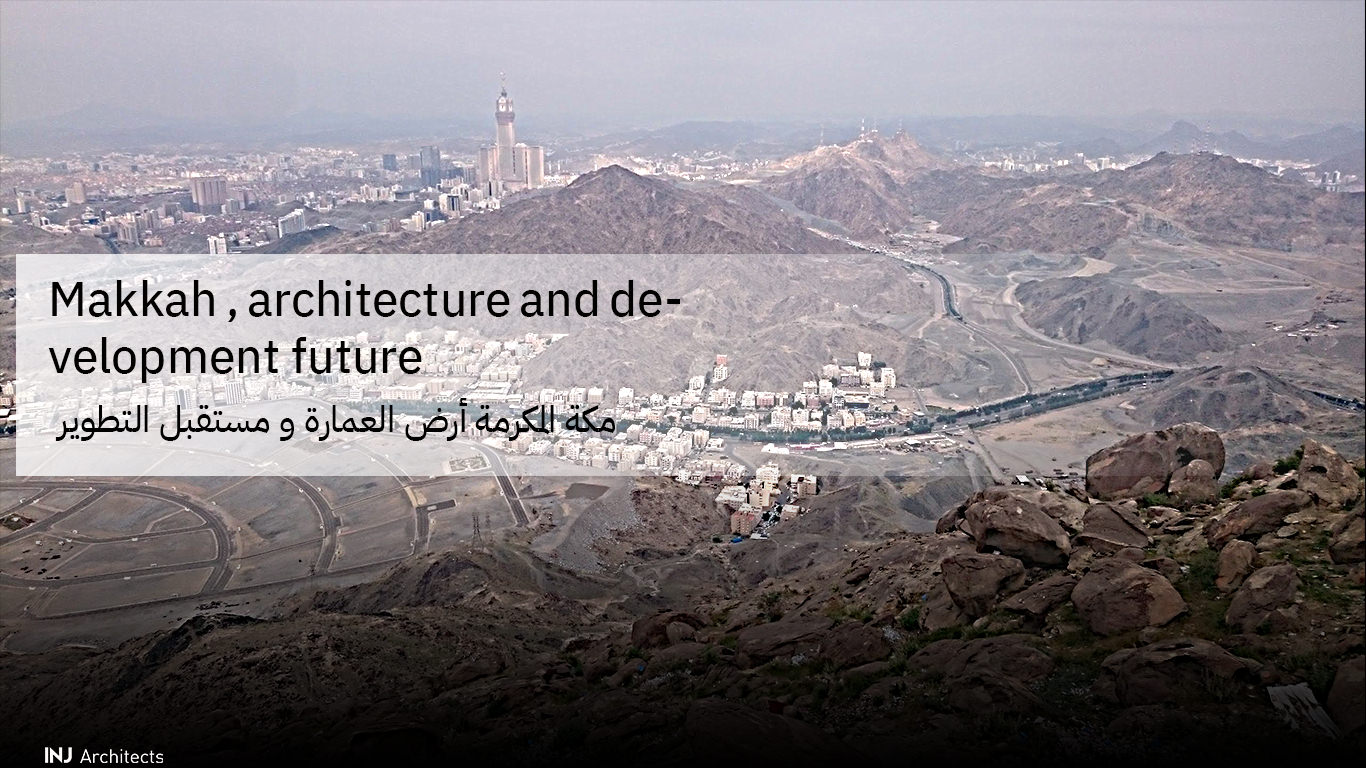
Makkah’s urban transformation cannot be read simply as a race for larger buildings or a different skyline. The city serves permanent residents and guests whose numbers vary through the year, within a mountainous setting and a network oriented toward the Grand Mosque and the holy sites. Architectural quality here therefore depends on coordinating capacity, movement, shade, services and spatial legibility—not on the façade alone.
Over recent decades, hospitality, transport and public-realm projects have reshaped parts of the city. It is more accurate to understand this as a sequence of transformations at several scales than as a single “architectural revolution” with a fixed beginning and end. Every new building enters an existing system of pedestrians, vehicles, services and urban memory, and its contribution should be evaluated within that system.
Why Makkah requires a different urban reading
The reading starts with the human journey. Saudi Arabia’s Pilgrim Experience Program describes more than 200 touchpoints across the stages of preparation, arrival, worship and departure. For architects, this is a useful spatial principle: the kerb, entrance, lift, waiting area, baggage route and wayfinding system are not isolated components. They form a sequence, and the clarity of each link affects how the whole journey is experienced.
This expands the architectural brief. A project must address more than room count, prayer area or commercial use. It should define who arrives, when peaks occur, how guest, staff and service routes intersect, and what alternatives remain available as density changes. These early questions are the basis of a building that can operate during ordinary days and seasonal peaks.
Capacity is not a single number
Effective capacity is set by the narrowest point in a movement chain: a gate, lobby, stair, lift, screening point, loading bay or passage to the street. Gross area divided by occupant count is therefore insufficient. The team needs to model peak movement in stages, test travel times, separate service flows, provide intelligible accessible routes, and compare operating scenarios before the plan is fixed.
Construction project management becomes part of the design response when these relationships are translated into coordinated work packages and operational phases. Phased handovers, protection of existing routes and coordination between movement and building services are architectural decisions as much as construction decisions.
Topography belongs in the architectural section
Makkah’s mountains and valleys create level changes that should not be deferred to the end of design. The solution begins with a section connecting street, entrance, lobbies, lifts and exits while also showing stormwater, shade and servicing. Within a steep site, vertical connection can matter more than the horizontal distance on plan, especially where pedestrian and vehicle levels overlap.
Retaining walls, podiums, plinths and spaces between buildings consequently become visible urban elements rather than background engineering. They can be shaped as legible edges, stepped entrances and shaded waiting places, preventing level changes from becoming spatial barriers.
Movement comes before the object
Masar Destination provides a declared example of integrated planning in Makkah. Its official material describes approximately 1.2 million square metres, with pedestrian and vehicle movement separated and coordinated with metro, shuttle buses, two main roads, tunnels and a principal pedestrian route. The lesson is not the project’s scale, but the decision to make mobility a structuring element of the masterplan.
At the scale of one building, this means drawing an arrival map before shaping the mass: where do pedestrians come from, where do vehicles stop, how do staff and service teams enter without unnecessary crossing, and where does a visitor change from transport to walking? Clear transitions reduce reliance on added signage and make the building understandable through its organisation.
Identity is spatial continuity, not applied ornament
A building does not relate to Makkah simply by adding an arch or pattern to an otherwise generic envelope. Continuity is expressed through the rhythm and depth of openings, shaded thresholds, the way a building meets the ground, and materials that tolerate intensive use and can be maintained. A study of Hejazi architecture can reveal principles of ventilation, privacy and shade that may be reinterpreted for contemporary programmes and construction rather than copied literally.
The skyline also needs to be tested from more than one viewpoint: approach roads, nearby pedestrian routes and public spaces. Massing studies should consider height transitions and the legibility of landmarks. The objective is a coherent composition that respects the place’s centrality, not a visual contest between neighbouring buildings.
Climate and comfort across the journey
Comfort begins before the building entrance. Continuous shade, reduced direct solar exposure, suitable external materials, resting points and drinking-water locations all influence a person’s ability to complete a route. Decisions should be supported by solar and wind analysis and field measurements, rather than assuming that a formal gesture will automatically deliver performance.
Sustainable design starts by reducing heat gain and improving envelope and shade before selecting systems. In Makkah, the unit of assessment must expand from the building to the urban journey. An interior may perform well while the route between transport and entrance remains exposed, so both conditions should be tested together.
A building is part of an operating system
A robust plan gives maintenance, waste, deliveries, security and emergency response clear spatial provisions without confusing guest movement. It also allows parts of a project to close for maintenance while essential routes remain available. These relationships cannot be resolved through general diagrams alone; they require operating schedules, defined responsibilities and rehearsed scenarios before opening.
Within an integrated architectural workflow, decisions are reviewed across architecture, structure, building services and operations from the early stages. Coordination protects the design idea by finding conflicts while change is still manageable and by ensuring that details can be built, accessed and maintained.
A balanced framework for urban transformation
Any new project in Makkah can be tested through five connected questions. Does it improve the user journey? Can its narrowest points handle peak movement? Does its section respond clearly to topography and climate? Can it be operated and maintained in phases? Does it add to local identity through scale, material and public space? A balanced answer matters more than maximising any single indicator.
This framework also requires documenting what merits conservation before intervention, understanding the value of fabric, views and routes, and then deciding what can be adapted and where a new addition is appropriate. The discipline of urban heritage conservation offers useful tools for evidence-based recording and diagnosis. Urban transformation can then accumulate knowledge and serve the place instead of merely replacing one image with another.